


- 12:10 h
- 25.11 km
- 1,583 m
- 1,502 m
- 1,504 m
- 2,696 m
- 1,192 m
- Start: Riederalp, top station of aerial cable car Mitte
- Destination: Belalp, top station of aerial cable car
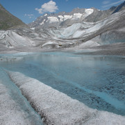
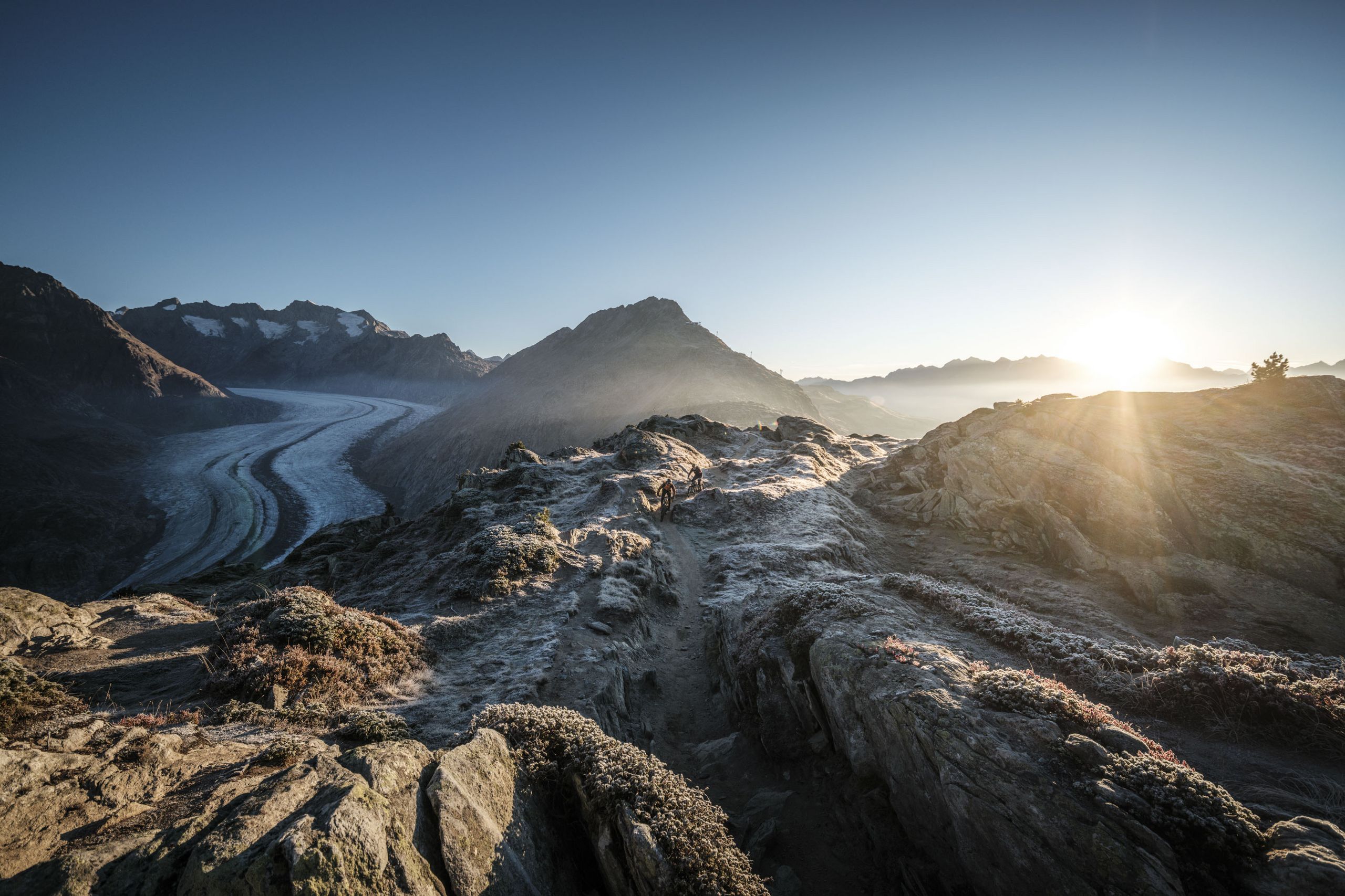
From the mountain station of the Riederalp Mitte cable car, take the well-maintained hiking trail via Riederalp West to Riederfurka. Once there, you’ll be greeted by your first highlight: the Pro Natura Centre Aletsch at Villa Cassel. Continue from Riederfurka via the Teiffe Wald forest down to Lake Grünsee and cross the Riederalp – Belalp suspension bridge to the Aletschi on the other side of the valley. You’ll then make the climb via Leng Acker to the chapel, continuing along the connecting path to the spectacular Oberaletsch panoramic trail. This will initially take you through the Oberaletsch gorge and then along the Oberaletsch glacier on the right-hand side of the valley up to the SAC Oberaletsch mountain hut (2,640m). The return journey follows the same route up to the Walkenen region. From there, follow the path in a westerly direction down to Belalp, where you’ll take the cable car to Blatten bei Naters and the PostBus to Brig, before completing your journey by train.
Please note: Difficulty: T3


Good to know
Best to visit
Directions
Tour information
Stop at an Inn
Summit
Equipment
We recommend:
- good footwear
- clothing suitable for the weather: always carry a waterproof jacket
- hat or cap
- sunscreen
- bottle for water
- picnic
- camera
- binoculars (optional)
- hiking poles (optional)
- printout of this hike (click «Print» icon, to download)
Directions & Parking facilities
- Limited parking spaces (charges apply) at Mörel-Filet station. Further parking options are signposted.
- Large pay multi-storey car parks at the entrance to Mörel-Filet and in the village centre.
Additional information
Aletsch Arena AG
Furkastrasse 39
CH-3983 Mörel-Filet
+41 27 928 58 58
info@aletscharena.ch
www.aletscharena.ch
Literature
Author´s Tip / Recommendation of the author
Safety guidelines
Use of the trails and the information on this website is at hikers’ own risk. Local conditions may entail changes to routes. Aletsch Arena AG accepts no liability for the accuracy and completeness of information on this website.
- Bring a map. Download full description of this route including large-scale map by clicking on «Print» icon, top right of this page.
- Use marked trails only, and observe all signposting – for your own safety, to safeguard grazing animals and to avoid disturbing wildlife.
- Close gates after passing through.
- Please be considerate to other trail users, and to the plants and animals.
- Do not leave any waste in nature.
Inform others of the route you plan to take. Whenever possible, avoid going alone.
Do not venture onto glaciers without a mountain guide.
Take note of the warning signs that point out the constant danger in river beds and along watercourses below dams and reservoirs: water levels may rise rapidly without warning.
Map
Nearby


