


- 2:45 h
- 8.65 km
- 196 m
- 355 m
- 1,174 m
- 1,446 m
- 272 m
- Start: Blatten bei Naters, valley station (1332 m)
- Destination: Ried-Mörel village - gondola lift
The Massaweg trail will remain closed for the coming hiking season due to the consequences of the forest fire in Riederwald in summer 2023. For safety reasons, the hiking trail will not be open until at least the end of March 2025.
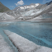
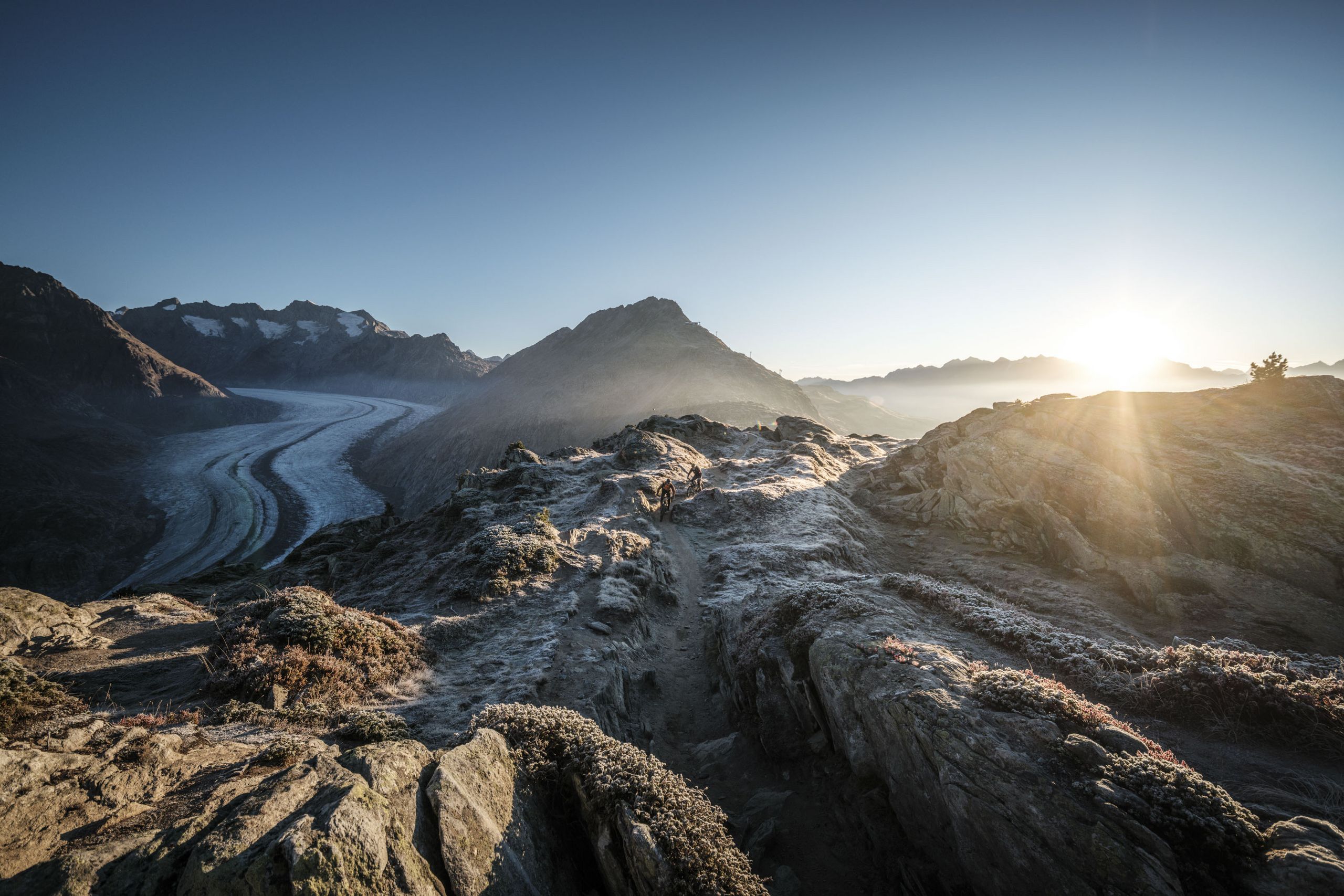
The Massa Trail leads you from Blatten bei Naters via the Blattnerschliecht forest to Gragg and from here along the former Suone Riederi, which was first mentioned in 1385, to Ried-Mörel. The steepest cliff face, around which six long canals led at dizzying heights until the end of the 1930s, is now bypassed by a short tunnel. Here you can enjoy the beautiful view of the Rhone Valley and the Valais Alps.

Good to know
Best to visit
Directions
On the Massaweg you have the option of leaving the trail earlier. For example, you can leave the trail at Ebnet and walk to Bitsch. From Bitsch you can walk the Red Mile through Naters towards Brig.
Blatten bei Naters - Massa - Gragg - Steischlag - Schwarzes-Flesch - Rischwald - Roti Flue - Ried-Mörel
Tour information
Cultural Interesting
Familiy-Friendly
Stop at an Inn
Equipment
Directions & Parking facilities
From western Switzerland: A9 Lausanne - Vevey, or north-western Switzerland: A12 Bern - Vevey: A9 - Sierre: main road Sierre - Brig
From north-western Switzerland: A6 Berne - Thun - Spiez: main road Spiez - Kandersteg (Lötschberg tunnel car transport) - Goppenstein - Gampel - Brig
From eastern and central Switzerland: Andermatt - Realp (year-round Furka car transport; in summer via Furka Pass) - Oberwald - Brig
From Ticino (in summer): Airolo - Nufenenpass - Ulrichen - Brig
Or via Centovalli - Domodossola - Simplonpass - Brig
From Italy (Aosta, Mt. Blanc Tunnel): Aosta - Grand Saint Bernard tunnel (over the pass in summer) - Martigny: A9 motorway - Sierre: Sierre - Brig main road.
Or via Domodossola - Simplon Pass - Brig
Blatten bei Naters
From Brig you can reach Blatten bei Naters via Naters, then take the cable car to the car-free Belalp.
You can find more info at:
You can find the timetable and further information on how to get there at: www.belalp.ch
Additional information
Belalp Bahnen AG
Blatten - Belalp Tourismus AG
Author´s Tip / Recommendation of the author
Safety guidelines
Despite the " impossible to miss " markings of the hiking trails, we recommend for safety reasons to always have an appropriate hiking map with you, so that you can quickly find your way to a safe area in case of a thunderstorm or an emergency, for example.
Especially in autumn, you should also be aware that leaves lying on the ground can hide bumps, roots, stones or holes in the path. After storms, trees can still fall over or branches can fall down. Especially in adverse weather conditions, muddy and slippery passages can occur on natural paths. You have to expect this kind of path impairment when you go on a hike.
Not all rocks or precipices are secured with ropes or railings. In some cases surefootedness is required. If you are of the opinion that certain sections of the trail are not passable for you, you should avoid them.
Nearby


