


- 3:00 h
- 3.04 km
- 373 m
- 149 m
- 2,648 m
- 2,871 m
- 223 m
- Start: Bettmerhorn, top station of aerial cable car
- Destination: Eggishorn, top station of aerial cable
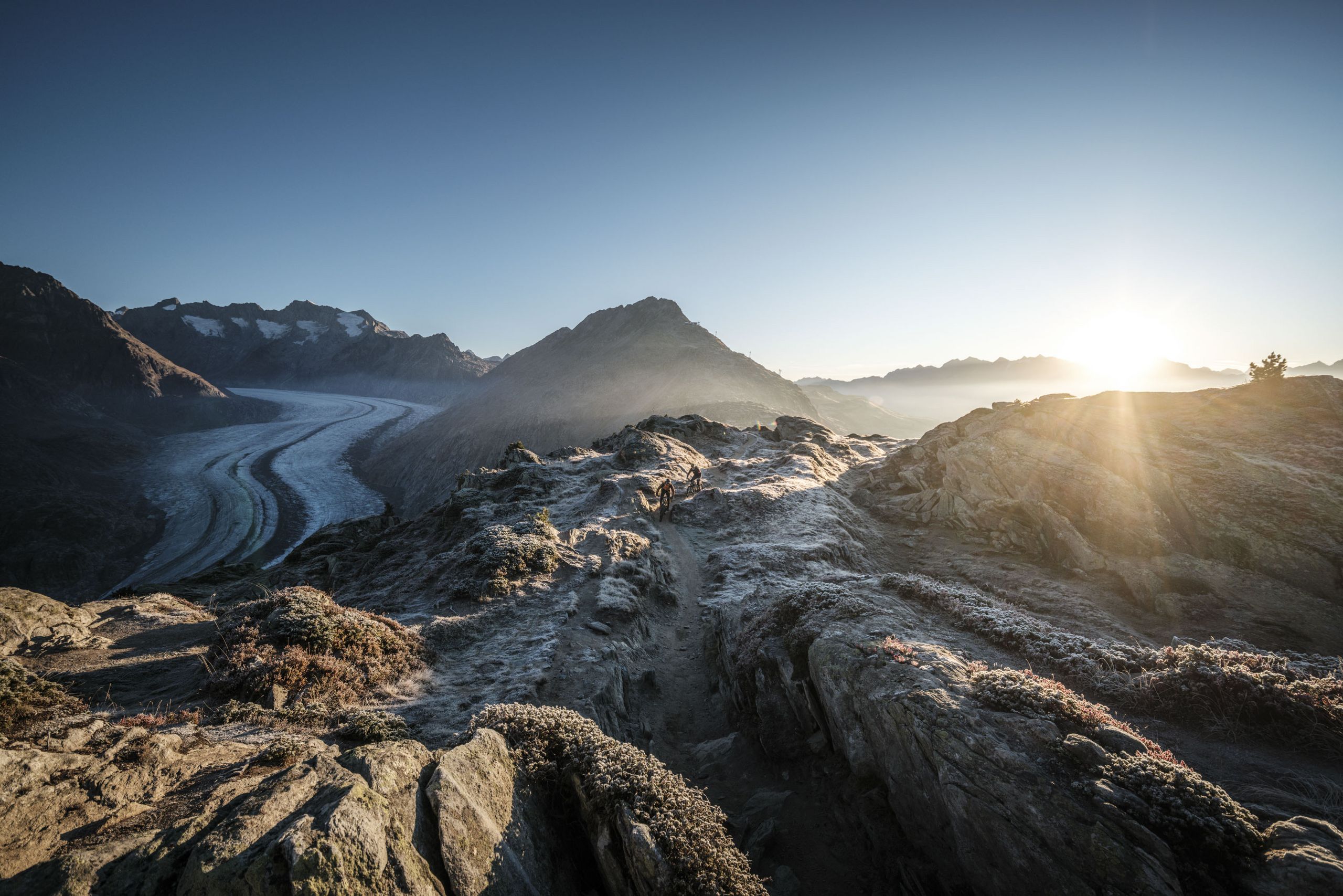
The hike starts at the Bettmeralp cable-car mountain station. It takes about half an hour to reach the summit of the Bettmerhorn (2,647m) via a fixed rope route. From there you follow the partly exposed but well-secured ridge trail for about 1.5km, until you reach the steep descent down to Elselicka. Cable handrails are provided for your safety. The path along the ridge is designated an Alpine Route, meaning that it is suitable only for sure-footed hikers with no fear of heights! Keep to the white/blue marked path on this section! From Elselicka, the route follows a well-maintained hiking trail up to the mountain station of the Eggishorn cable car (2,869m), the end of the UNESCO high-altitude trail.


Good to know
Best to visit
Directions
Tour information
Cultural Interesting
Stop at an Inn
Summit
Equipment
- good footwear
- clothing suitable for the weather: always carry a waterproof jacket
- hat or cap
- sunscreen
- bottle for water
- picnic
- camera
- binoculars (optional)
- hiking poles (optional)
- printout of this hike (click «Print» icon, to download)
Directions & Parking facilities
Additional information
Furkastrasse 39
CH-3983 Mörel-Filet
+41 27 928 58 58
info@aletscharena.ch
www.aletscharena.ch
Literature
Author´s Tip / Recommendation of the author
Safety guidelines
People undertaking this activity on the basis of the information on this website do so at their own risk. Local conditions may lead to changes in route and exposure to natural hazards. We accept no responsibility for the accuracy of the information on this website or for the conditions under which this activity is undertaken. If in doubt, please contact the destination in advance.
- Bring a map. Download full description of this route including large-scale map by clicking on «Print» icon, top right of this page.
- Use marked trails only, and observe all signposting – for your own safety, to safeguard grazing animals and to avoid disturbing wildlife.
- Close gates after passing through.
- Please be considerate to other trail users, and to the plants and animals.
- Do not leave any waste in nature.
- Take extra care protecting yourself from the sun at altitude. UV radiation can be exceptionally strong, even in cloudy weather.
- Plan hike carefully: take into consideration fitness level of each participant, weather forecast and season.
- Weather conditions can change quickly in the mountains, without warning. Appropriate clothing is therefore essential, along with adequate supplies of food and water. In uncertain weather, turn back in good time.
- Inform others of the route you plan to take. Whenever possible, avoid going alone.
Map
Nearby


